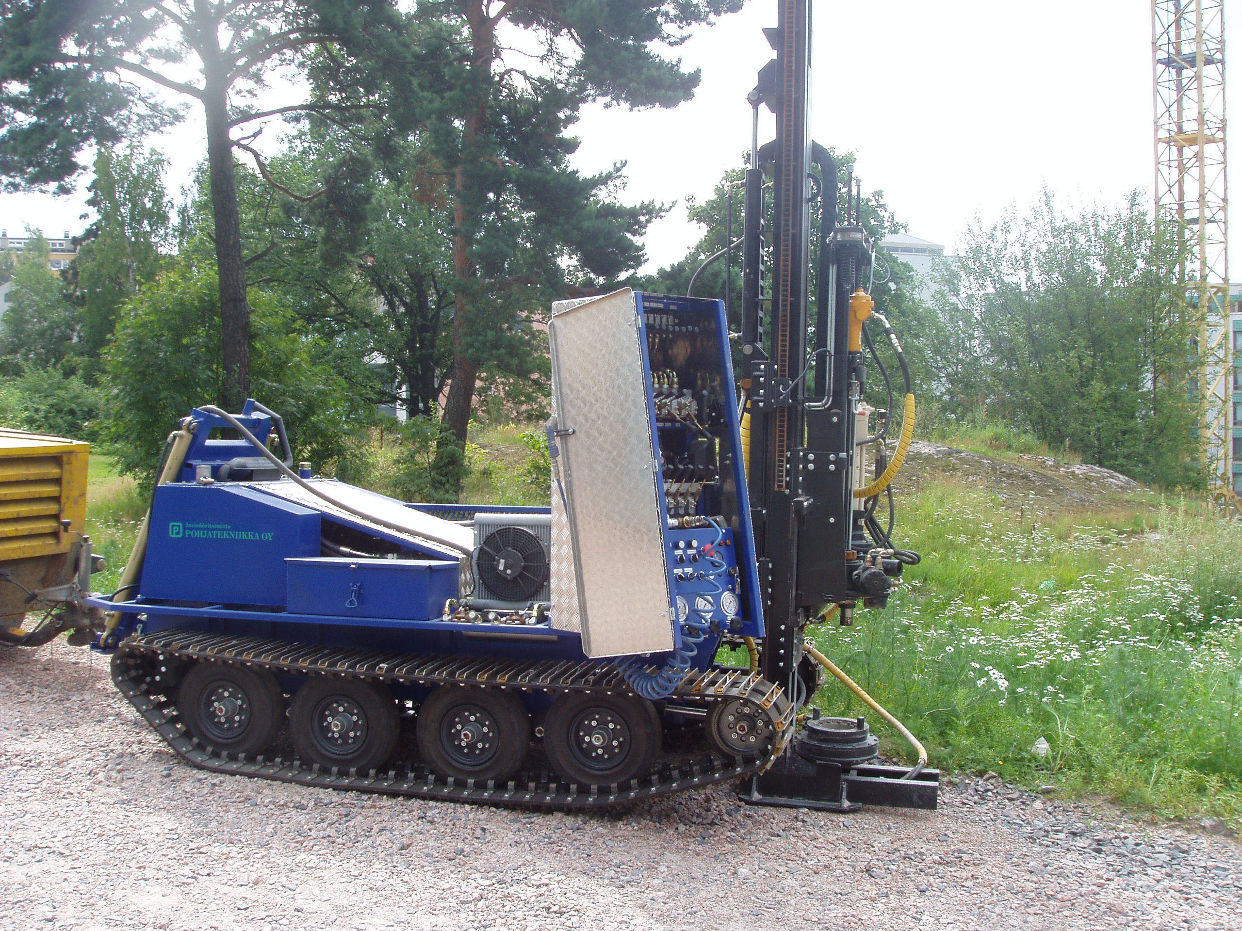
RESEARCH In our operations, we use up-to-date equipment that we renew as needed.
• Five hydraulic drilling units • Drill cutters for rock surface reinforcement, soil sampling and groundwater pipe installation
• Multifunctional drills - weight, press and reflector functions drill burring feature for piercing of fillings and frost and for securing rock surface
• Versatile sampling equipment • pore pressure measurement and inclinometer • Register, if necessary, real-time terrain workout
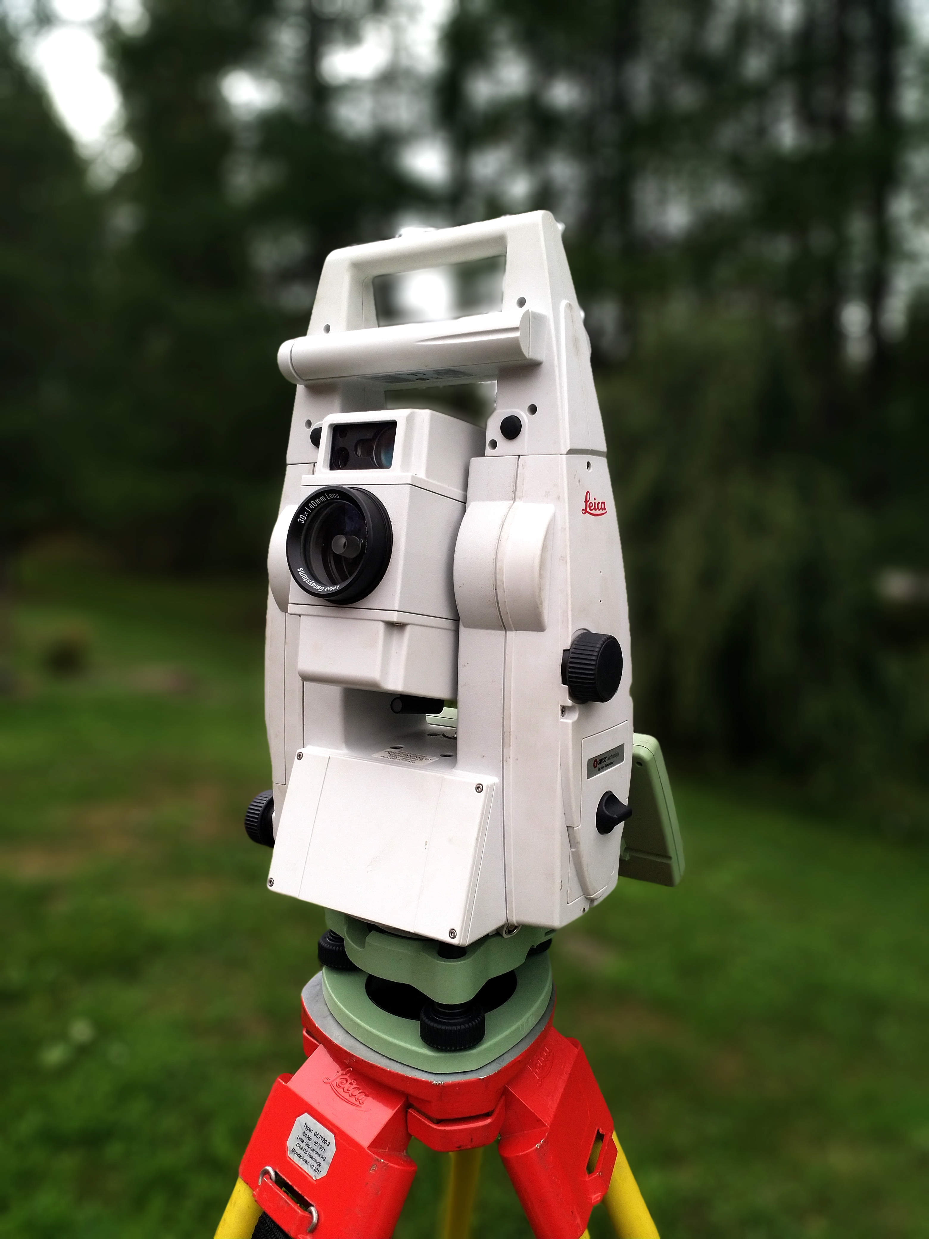
Tacheometry • We have access to, for example, Leica Viva TS15 laser robotic deck meters
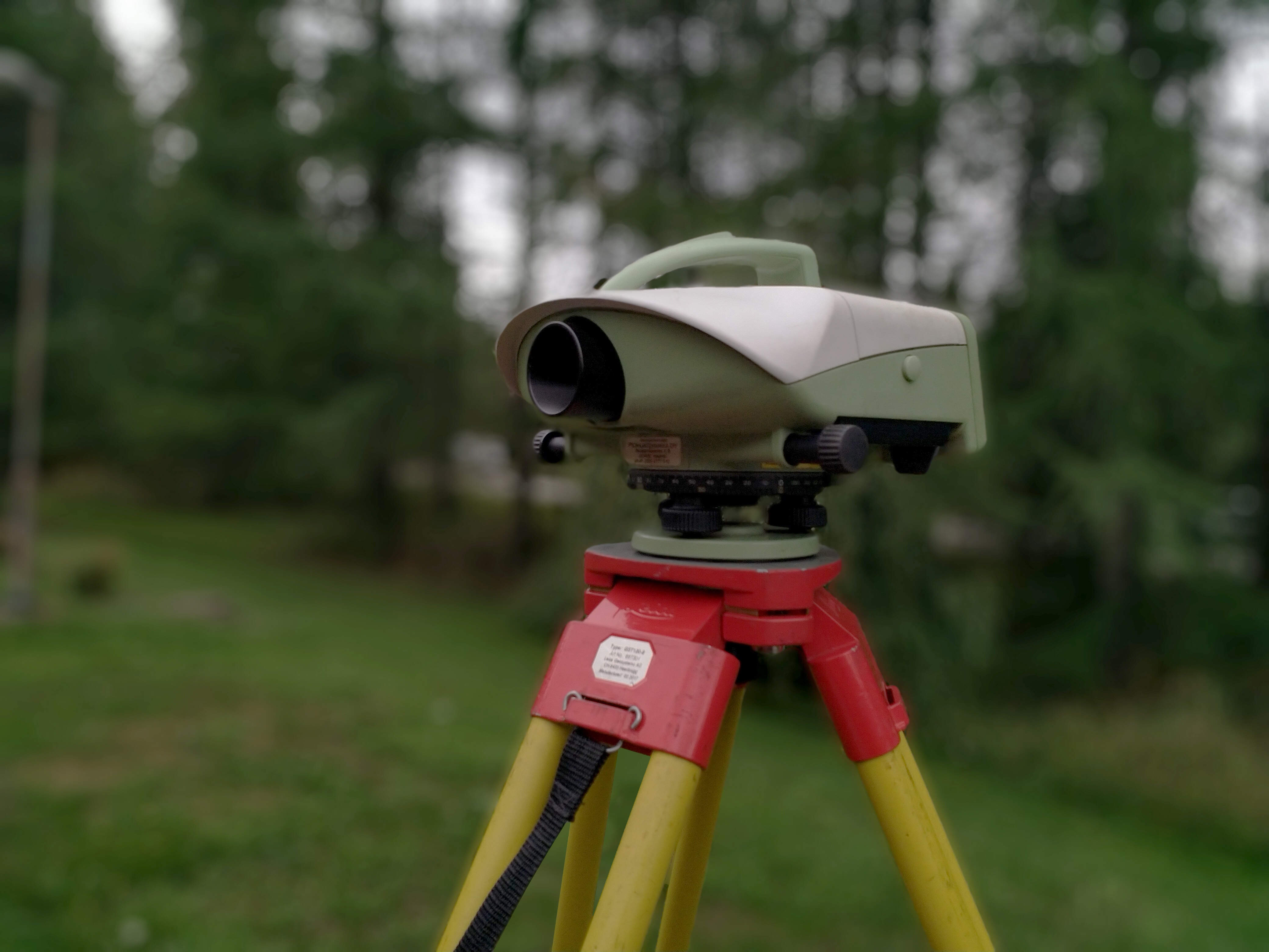
Precise gestures • We use eg. Leica DNA-03 precision lighting instruments
Laser scanning • Laser scans are made with Faro's Focus -3D scanner
GPS measurements • Satellite measurements with Leica and Trimble RTK measuring devices
We use advanced CAD applications in all design. The measurement data can be printed in all known CAD formats as 2D or 3D files.
We operate mainly in the 3D environment, so the client already receives accurate calculations of the building height and mass balance optimization at the design stage.
SOFTWARE We make all the printings of our measurements with subordinate software, widely compatible with various design systems.
Our software include, for example, - AutoCad Civil -AutoCad Architecture -AutoCad Map -MicroStation V8 + Terra Applications -Faro Scene and Scene LT